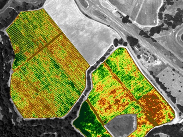
Access sophisticated precision ag technology for accurate and innovative farm management
Precision ag is a critical remote sensing application with the potential to impact any aspect of society. The use of UAVs in agriculture has been well-documented but the value of high-end data collectors mounted on the UAV or other vehicle is transforming data into agricultural treasure!
Peter Drucker’s saying, ‘what gets measured, gets improved’, highlights the importance of robust analysis and interpretation of data.
With precision ag, high-value crops can be planted, cared for, and harvested with the help of spectral data that leads to better decision-making. As a result, spectacular crop yields and healthier foods are achievable outcomes – of enormous value where agricultural success is a life-saving or life-enriching necessity.
Hyperspectral image sensors also monitor irrigation levels, pesticide and fertiliser effectiveness, and spot the telltale signs of invasive and hard-to-detect diseases. The key is to recognise these signs early and often, which is why continual airborne monitoring allows for trend analysis throughout the season.
From UAVs and aircraft as well as tractors and other mobile machinery, researchers can determine stress levels and overall plant vitality using hyperspectral image sensors at the VNIR (400-1000nm) and SWIR (900-2500nm) spectral ranges. These sensors operate in a line-scanning fashion, requiring movement to occur as the sensor builds a data-rich image cube containing all the spatial and spectral information within the field of view. GPS and LiDAR, plus the post-processing task of orthorectification, stamp the image data precisely. The end result is high-quality data that farmers and agriculturalists can use to make smart decisions.
Precision ag in Australia / New Zealand
In the Australian agricultural setting, hyperspectral imaging’s ability to cover distances with accuracy is a boon to primary producers seeking to maximise yield, minimise waste and manage scarce resources.
PAS is the Australian / New Zealand home of a range of sensors and analysers for any aspect of precision ag, including the Nano-Hyperspec and Micro-Hyperspec sensors from Headwall Photonics and the FieldSpec NIR models from ASD.
Headwall supplements its sensors with the industry’s best airborne hyperspectral software package called Hyperspec III. The package includes all the tools necessary to set up the sensor for airborne operation, and tie that operation in with GPS and LiDAR data streams. The software also manages more than one sensor at a time, permitting a single pass using a VNIR and a separate SWIR sensor for example.
Headwall’s sensors feature aberration-correction for precise image data from edge to edge. This wide field of view is particularly beneficial for the new breed of small, lightweight UAVs that require flight-path optimisation. The wider the field of view, the fewer passes over a plot of land the UAV (or aircraft) needs to make.
The ASD FieldSpec® line offers a wide range of configuration options for both contact measurements (such as leaves or in a soil profile pit) and stand-off measurements (such as those needed to measure canopy reflectance). The FieldSpec uses a flexible fibre optic cable that can be used with many different accessories and configurations, giving researchers many options for acquiring critical data.
Speak to PAS about the breadth of solutions available to meet the needs of precision ag applications and many others as well.
